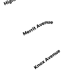
6 MERRITT ST
Owner Information
MURRAY CHARLES
6 MERRITT ST
GROVELAND, MA 01834


Property Details
6 MERRITT ST is classified as a Single Family Residential (Cape).
The primary structure on this property was built in 1966. There are 2457ft2 of built area within this property. There is 2457ft2 of residential/living space within this property. This property is listed as having 8 rooms.
6 MERRITT ST is valued at 486300. The land is valued at 159000 and the structures are valued at 327300.
This property is in Zone RB. Confirm with local Zoning Board authorities to ensure there are no overlays or other easements on this property.
The most recent deed for 6 MERRITT ST is recorded at the local registrar in Book 22347, Page 97. 6 MERRITT ST was last sold on 2004-01-30 for 420000.
Assessment data from fiscal year 2022.
Flood Data
According to the FEMA National Flood Hazard Layer, this property does not appear to be in a flood zone. It may also be in an area not yet reviewed. Nonetheless, confirm this information prior to taking any action.
To view the flood hazards around this property, create a FEMA "Firmette" Map of the area around 6 MERRITT ST.
Broadband Internet Providers
| Provider | Type | Bandwidth (mbps) | |
|---|---|---|---|
| GCI Communication Corp. | Satellite | 0 | 0 |
| HughesNet | Satellite | 25 | 3 |
| VSAT Systems, LLC. | Satellite | 2 | 1 |
| Viasat Inc | Satellite | 100 | 3 |
| Verizon New England Inc. | DSL | 5 | 0 |
| Comcast | Cable | 1000 | 35 |
| T-Mobile | Fixed Wireless | 25 | 3 |
Broadband service provider data from December 2020.
Adjacent Properties
- 4 MERRITT ST
Single Family Residential owned by CYR TRS AMY E - 9 HIGHLAND AV
Single Family Residential owned by BELISLE BRYAN L - 11 HIGHLAND AV
Single Family Residential owned by BALLETTO TRS ROBERT E - 15 HIGHLAND AV
Single Family Residential owned by KING MATTHEW - 8 MERRITT ST
Single Family Residential owned by DANIELS TYLER